
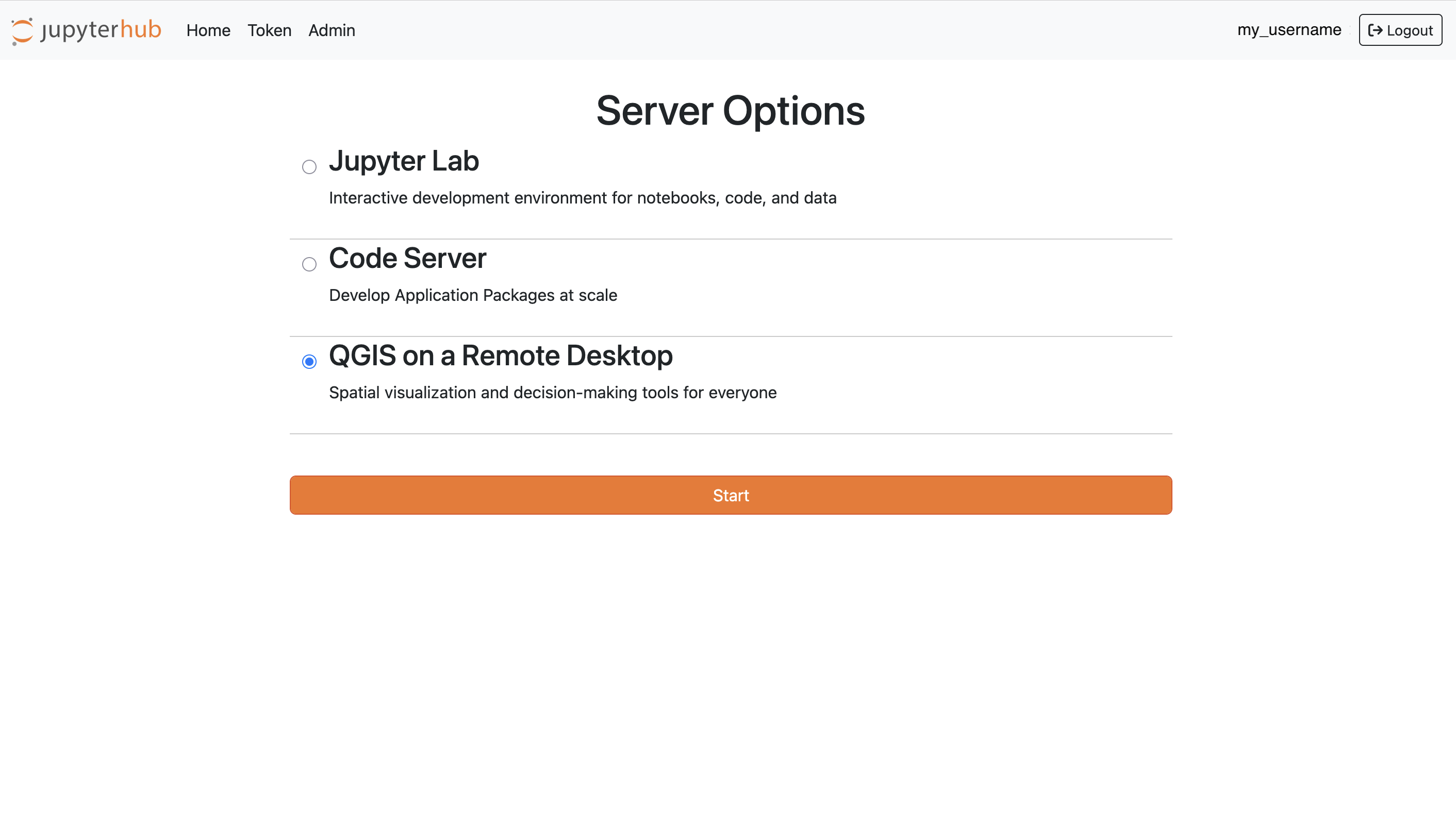
QGIS as a Remote Desktop
Overview
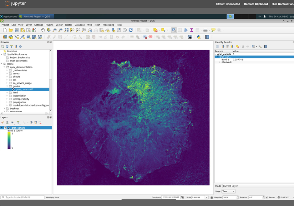
The Geographic Information System capacity within the APEx Project Environments primarily leverages the power of the QGIS Software, being delivered to the APEx users as a Remote Desktop software.
This APEx tailored User Workspace allows users to maintain a familiar environment and rich feature set while benefiting from the power and resources of server-side computing. This is particularly advantageous for those working on resource-intensive tasks or needing access to a consistent development environment from various locations and devices.
The server-based nature ensures that users are not constrained by their local machine’s hardware capabilities, allowing them to harness the computational power of remote servers.
Software Architecture
The APEx QGIS workspace is a fully-fledged Geographic Information System delivered as a cloud-based user workspace, tailored to support the activities of Earth observation (EO) projects.
Each QGIS workspace comes equipped with the free and open source software project hosted on QGIS.org association, as well as with a private data products catalogue. These features empower developer users to edit and build EO-based mapping products and geospatial workflows, accelerating project outcomes within a dedicated, tool-rich environment.
Key Features
The APEx QGIS workspace includes several features that make it suitable for both individual researchers and teams working on EO research and applications.
- Customisable workspaces
Configure your workspace with tools and settings tailored to your specific needs, including geographic features digitising tools, geospatial analysis workflows and map production options, as well as advanced functions from a plethora of 2000+ plugins developed by the QGIS community. - EO-focused tools
Access specialised plugins such as for raster data analysis, or for visualisation of multi-sensor time series, all specifically designed for Earth observation tasks. - Support for every major GIS toolbox
Native support for a wide range of geospatial data management toolboxes, including GRASS and GDAL. - Collaborative work
Store, manage, and share QGIS projects with the ability to connect to external data sources as needed.
Showcase Scenarios
- Collaborative Projects
Teams can work collaboratively on GIS projects, sharing data and resources in real-time. A group of data scientists might collaboratively develop crop yields scenario maps based on various data inputs.
Examples
Several examples are under development and will be added on this page.
| Project | URL |
|---|---|
| APEx (Demo) | https://apphub.demo.apex.esa.int/ |
| EO4CM | https://apphub.eo4cm.apex.esa.int/ |
| EO4SEM | https://apphub.eo4sem.apex.esa.int/ |
| Information Factories | https://apphub.info-factories.apex.esa.int/ |
Additional information will be shared on this page as the project progresses.